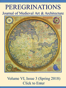
Volume 6, Issue 3 (2018)
Welcome to the Spring 2018 issue of Peregrinations: Journal of Medieval Art & Architecture
with the publication of the third biennial “Mappings” issue of Peregrinations. These special issues began as talks delivered over the past two years at the International Congress on Medieval Studies at Western Michigan University, Kalamazoo; or at the International Medieval Congress at the University of Leeds in England. Felicitas Schmieder, FernUniversität in Hagen, Germany, and Dan Terkla, Illinois Wesleyan University, organize the “Mappings” sessions, which have run at the IMC for the past eight years and at the ICMS for the past three years. Along with inviting audience members to consider speaking at subsequent congresses, they encourage all presenters to expand, deepen, and submit their work for publication consideration. The next step for each of these three issues has been for Terkla and Asa Simon Mittman to work with the excellent editors of Peregrinations to plan, assemble, and edit the issue. Peregrinations “Mapping” issues, therefore, are not congress proceedings; nor does presentation ensure publication: each issue is peer reviewed, and all submissions are thoroughly revised, often multiple times, after being accepted.
The chronological scope of “Mappings III,” as it is known around the virtual Peregrinations office, reaches back to antiquity with Emily Albu’s “The Roman Heritage of Medieval Maps,” through the Middle Ages in Felicitas Schmieder’s “Geographies of Salvation: How To Read Medieval Mappae Mundi,” into the fifteenth century with Paul Fermon’s “The Traditions of Geometrical Representation and the Rise of Local Mapmaking in the Pontifical City of Avignon (14th-15th Centuries)” and Christoph Mauntel’s “Fra Mauro's View on the Boring Question of Continents.” Margriet Hoogvliet moves the issue into the sixteenth century with “Producing and Reproducing Local Maps: The Example of Amiens,” and Jane Beal’s “Mapping Desire in Chaucer’s ‘To Rosemounde,’ Shakespeare’s ‘Rape of Lucrece, and Donne’s ‘A Valediction: Of Weeping’” rounds out the issue and takes it into the seventeenth century, pressing closer to modernity than the previous two volumes.
As these titles indicate, their authors’ interests range as widely as the issue’s chronological scope. Emily Albu extends the reach of her recent monograph, The Medieval Peutinger Map: Imperial Roman Revival in a German Empire, to explain how Greco-Roman thought enabled the conceptualization of a Roman world map. She then shows us why the Romans believed that displays of their geographical knowledge affirmed their hegemony over the surveyed and depicted territories. Felicitas Schmieder takes on the old question of “accuracy” on medieval mappae mundi from a new perspective, looking at ways that medieval mapmakers sought to incorporate the latest information they had, which they received as empirical evidence of distant locales. Their literal content was, she argues, essential for the multi-level symbolic readings medieval viewers took toward the “geography of salvation.”
Paul Fermon details the particular type of local cartography that developed along the Rhône valley and the influence that the papal corpus in Avignon had on that kind of mapping. He focuses on Marino Sanudo and Paolino Veneto’s close working relationship during Sanudo’s time in Avignon (1321-1322) to show us what kinds of local maps they used. Fermon then details Sanudo and Veneto’s diffusion of maps to important ecclesiastics in Avignon and to Provençal lords at the King of Sicily’s court.
Christoph Mauntel tackles a discussion of the three parts of the world by Fra Mauro, fifteenth-century Venetian cartographer. This is a matter Mauro himself terms a materia tediosa, a boring topic, but Mauntel provides a fascinating discussion of it, exploring the complex processes through which the mapmaker rethought the old question of the division of the world. Magriet Hoogvliet mines an unusual trove of probate inventories from the so-called “long fifteenth century” in Amiens, which she uses to approximate the locations of all of the city’s biblical texts translated into French. Through this mapping project, she is able to make arguments about lay reading practices in Amiens. Finally, Jane Beal looks to three of the great medieval and early modern English poets to see how they used maps as metaphors for women. She considers Chaucer’s “To Rosemounde,” Shakespeare’s “Rape of Lucrece,” and Donne’s “A Valediction: Of Weeping,” examining how they manipulate the same symbol toward three entirely different ends.
We biennial editors are incapable of describing what a delight Sarah Blick, general editor of Peregrinations, is to work with: even-handed, ever engaged, encouraging, and just flexible enough. We have benefited from Sarah’s guidance while working on all three issues and, on this one, from Bradley Hostetler’s hard work. Without them, we would be unable to welcome you to Peregrinations 6.3, or to take this opportunity to invite you to “Mappings” at the ICMS and ICM in 2018 and beyond.
--Asa Mittman and Dan Terkla
This issue also features four excellent book reviews that cover topics from Carolingian manuscripts to late-Gothic table fountains. Rounding things out are short summaries of new archaeological and other medieval Discoveries such as hidden murals brought to light and reports on medieval graffiti and new-found amphora with important inscriptions.
Our grateful appreciation and thanks for partial funding provided by Kenyon College. Associate Editor: Bradley Hostetler. Programming and copy-editing: John Pepple; Artistic Advising: Karen Gerhart.
Sarah Blick, Editor & Bradley Hostetler, Associate Editor
Feature Articles
Geographies of Salvation: How to Read Medieval Mappae Mundi
Felicitas Schmieder
Fra Mauro’s View on the Boring Question of Continents
Christoph Mauntel
Producing and Reproducing Local Maps: The Example of Amiens
Margriet Hoogvliet
Book Reviews
Eric M. Ramírez-Weaver, A Saving Science. Capturing the Heavens in Carolingian Manuscripts (Penn State University Press, 2017)
Mechthild Haffner
Anja Selinger and Willy Piron (eds.), Choir Stalls and Their Workshops: Proceedings of the Misericordia International Colloquium 2016 (Cambridge Scholars Publishing, 2017)
Betsy Chunko-Dominguez
Discoveries

